Monitoring our UK Marine waters
Monitoring marine pollution in UK waters is essential for understanding how coastal and offshore ecosystems are changing, where pressures are emerging, and whether management actions are helping seas recover. Long-term, high-quality observations of nutrients, chlorophyll, dissolved oxygen, suspended sediments, contaminants, underwater noise and biological communities provide the evidence base needed to assess environmental status and detect change over time. These data underpin the UK’s national marine assessments, including reporting for OSPAR and the UK Marine Strategy, helping to track progress towards Good Environmental Status and inform decisions that protect the health, productivity and resilience of our seas.
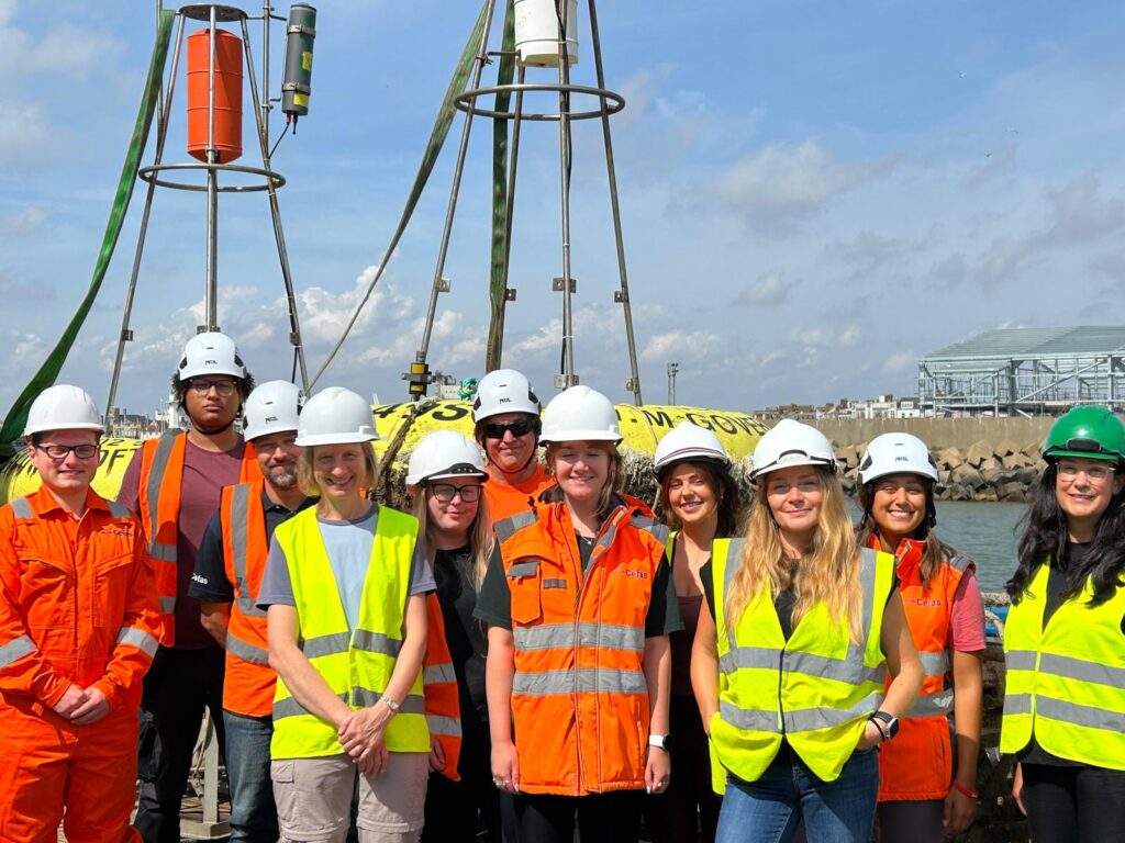
Cefas delivers much of this evidence through regular surveys on the RV Cefas Endeavour, where scientists collect seawater samples, deploy and recover autonomous instruments, and gather continuous measurements from ship-based systems. Once ashore, samples and sensor records are quality assured, analysed and combined to support national monitoring and assessment. To spotlight how this important work is done, a member of the Cefas communications team, Fiona Vogt, joined the quarterly Water Quality and Moorings Survey, following the scientists and crew as they collected the data that informs marine assessment, policy and management, to highlight the impact of this science in strengthening food security and supporting the marine environment and economic growth.
Day 0 – from Lowestoft Harbour to the North Sea
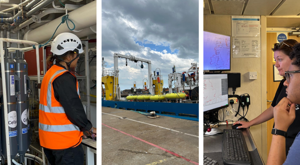
Day 0 began alongside the quay in Lowestoft, with the RV Cefas Endeavour being prepared for departure and the survey team making final checks before heading to sea. Scientific equipment was being readied, sampling plans were reviewed, and the team were working through the practical steps needed to ensure the first stations could be completed safely and efficiently once the vessel left harbour. For the communications team, joining the survey meant being embedded in this busy preparation phase: observing how the science is organised, speaking with the survey leads and crew, and beginning to capture the people, equipment and planning behind the monitoring programme.
Before sailing, the communications role was also to understand the rhythm of life onboard: where filming and photography could take place safely, when scientists and crew would be available to talk, and how to document the work without interrupting operations. The vessel is both a workplace and a home during survey, and so the first day included familiarisation with the ship, safety procedures, and the working areas where water sampling, mooring preparation and deck operations would take place. Cefas Endeavour is operated and maintained by AW Ship Management (AWSM) and is also home to their crew, who work closely with Cefas scientists, providing essential support.
The plan was to capture the journey from ship to assessment: how samples are collected, instruments deployed and recovered, and observations turned into evidence for the UK marine environment.
Once preparations were complete, the Cefas Endeavour left Lowestoft harbour and headed out towards the first survey stations in the North Sea. The programme runs around the clock, with 12-hour day and night shifts covering water sampling, instrument checks, deployments and recoveries.
The communications work kept pace with the survey, documenting activity as it happened. After watching from the back deck as we left Lowestoft harbour and sailed under the bridge, I was happy to have an early night, to make sure we were ready for an early start.
Day 1 at sea – monitoring begins in the southern North Sea
Day 1 began early, with calm seas, clear skies and the survey already well underway. The scientific programme had begun overnight, with hourly seawater sampling and continuous FerryBox measurements recording changing conditions as the vessel moved between stations.
At 03:00, the team had deployed a SmartBuoy fitted with near real-time water quality sensors. These SmarBuoy moorings provide long-term observations of temperature, oxygen, turbidity, chlorophyll and other indicators, helping scientists track environmental change and pollution pressures over time.
See the SmartBuoy webpage for more information and latest data.
At 6.00am, I met Izzy Lake, the Survey Lead, and Elise Brabben, the deputy Survey Lead on the bridge to talk through the day’s schedule and how best to share the importance of the work.
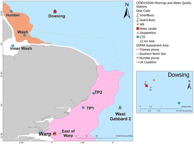
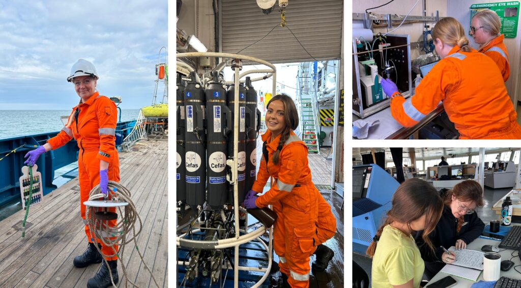
Throughout Friday, we stopped at stations across the Thames River plume region, retrieving and deploying equipment including SmartBuoys, Noise Seabed Landers, the CTD (Conductivity Temperature Depth) rosette, a Secchi disk and zooplankton ringnet. Seawater samples were also collected for nutrients, chlorophyll-a, suspended particulate matter, oxygen, salinity, Coloured Dissolved Organic Matter (CDOM) and phytoplankton. Together, these measurements show how nutrients, suspended sediments, oxygen levels and plankton communities are changing across the survey area. Environmental DNA, or eDNA, was also collected to support biodiversity monitoring method validation.
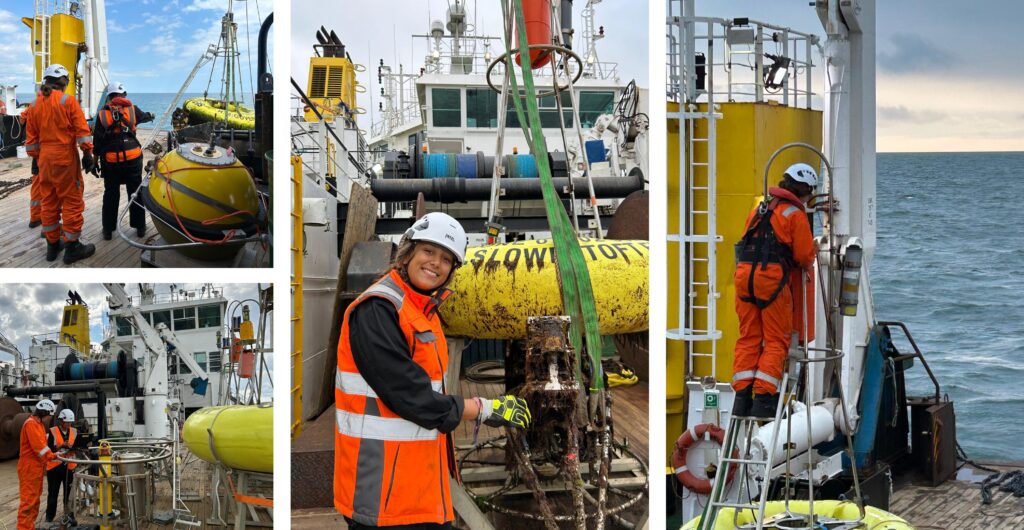
Noise Seabed Landers record underwater sound at the seabed using hydrophones, contributing to national assessments of underwater noise as a pressure on the marine environment. The UK has a marine noise threshold, and we report what is recorded, which ranges from boat traffic to harbour porpoises. On this survey, one lander was deployed at Warp in the Thames Estuary.
Retrievals and deployments rely on close coordination between Cefas scientists and the AWSM crew. The work required careful planning, clear communication and suitable conditions, especially when heavy moorings, buoys and sensor frames were moved safely over the side of the vessel.
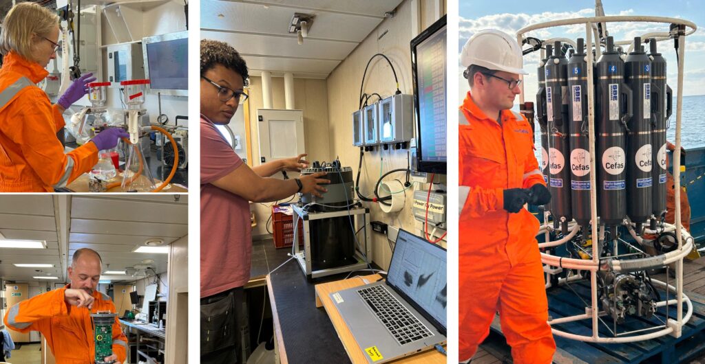
On the back deck, Cefas colleagues prepared SmartBuoys, Noise Seabed Landers and other moored instruments for deployment. Their work combines practical engineering skill, sensor knowledge and careful safety procedures, much of it prepared in the workshop before the vessel leaves port. The onboard Cefas engineer, kept the scientific systems running, troubleshooting alarms, power issues and data streams.
The water sampling team kept monitoring running throughout the survey. They deployed the CTD rosette, took Secchi disk and ocean colour readings, and processed samples. The CTD records conductivity, temperature to assess seawater clarity, and depth through the water column, while taking and preserving the seawater samples from the Niskin bottles from specific depths for laboratory analysis, building a picture of water column structure, light availability, nutrients and plankton communities.
As I reached the end of the first day, I was struck by the breadth of methods, skills and knowledge needed from scientists and crew to collect the evidence behind behind national marine assessments, from water quality and biodiversity to climate change.
After a full day of sampling, deployments, filming and conversations with the team, sea air, shift work and hearty food from the ship’s chefs made an early night very welcome.
Day 2 at sea – instruments, indicators and long-term evidence
Day Two continued across OSPAR Commission assessment areas in the southern North Sea, with the team collecting the physical, chemical and biological data needed to assess marine environmental status.
At Dowsing station, the CTD rosette was deployed to collect conductivity, temperature and depth profiles, alongside seawater samples from Niskin bottles. These data support eutrophication assessments and pelagic food web monitoring by linking nutrients, chlorophyll, dissolved oxygen, plankton communities and other indicators to ecosystem condition.
A Noise Seabed Lander was also deployed at Dowsing, protected by two guard buoys during its four-month deployment. The lander records underwater sound at the seabed and carries an Acoustic Doppler Current Profiler and CTD profiler, helping build a clearer picture of acoustic pressure and local water column conditions.
The Dowsing Waverider was serviced because the battery in the existing deployment was running low. A replacement mooring and Waverider buoy were deployed to maintain the long-term wave record used for flood forecasting and marine monitoring. Waveriders also measure sea surface temperature, contributing to evidence on changing seas and recent marine heatwaves.
Together, these instruments form part of a long-running national programme that combines ship-based sampling with in-situ moorings to provide consistent data for UK and regional assessments. Maintaining this evidence base over many years is essential for detecting change, understanding pressures and assessing progress towards Good Environmental Status.
The survey depends on a multidisciplinary team, including biogeochemists, engineers, analytical chemists, plankton specialists, data scientists, modellers, project managers, scientific survey leads and vessel crew. The AWSM crew are central to keeping the ship running safely and efficiently, enabling sampling, deployments and recoveries across a demanding programme.
Day 3 at sea – completing the survey and bringing the evidence home
By Day 3, the moorings section of the survey was complete, and the Cefas Endeavour was on the home stretch back towards Lowestoft. The focus shifted to completing the remaining transects (taking samples along a consistent route) across the Humber Plume and Wash assessment areas, where the team continued collecting seawater samples and supporting measurements needed for water quality assessment.
Sampling continued as the vessel moved between stations, adding to the survey record for nutrients, chlorophyll-a, suspended sediments, dissolved oxygen, plankton and other indicators. These measurements build a spatial picture of water quality across coastal and offshore assessment areas.
As the ship made its way back to Lowestoft, the scientific programme began to wind down. Metadata were checked and quality assured, samples were organised for return to the laboratory, and work areas were cleaned and packed down safely. This final stage is an important part of the survey process: good data depend not only on collecting the right samples, but also on accurate records, careful handling and consistent quality control.
Once ashore, the samples were taken to the Lowestoft laboratory for analysis. The resulting data feed into UK Marine Strategy and OSPAR assessments, both of which are reported on six-year cycles, helping determine whether UK seas are achieving or maintaining Good Environmental Status. Assessments draw on temporal trends as well as the latest observations, which means that each survey adds an important new layer of evidence while building on the historical record. Regularly updated data are therefore essential for every assessment cycle, ensuring changes in nutrients, chlorophyll, oxygen, sediments and plankton can be tracked consistently over time. The data also support calibration and validation of SmartBuoy, CTD, FerryBox and ship-based biogeochemical sensors, keeping year-round observations accurate and comparable.
The RV Cefas Endeavour spends more than 300 days at sea each year and is a strategic monitoring asset for the UK government. Surveys like this bring together ship-based sampling, autonomous moorings, sensor systems and laboratory analysis to provide the long-term evidence needed to understand environmental change and support healthy, productive seas.
Find out more about integrated marine monitoring to support UK and international ambitions to support healthy and productive seas in this blog.
Final thoughts
Spending time on board showed me how much preparation, coordination and technical work goes into each monitoring survey. Long before the vessel leaves port, equipment is prepared and tested, sampling plans are agreed, safety procedures are checked and teams work through the logistics needed to deliver a demanding programme at sea.
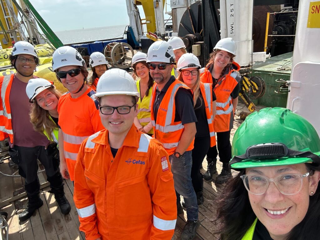
These surveys depend on an integrated, multidisciplinary team. Scientists, engineers, technicians, analysts, data specialists, survey leads and vessel crew all bring different expertise, but the monitoring only works because those roles come together as one coordinated effort. From deck operations and sensor checks to sample processing and laboratory analysis, each stage contributes to the evidence chain that helps explain what is happening in UK waters.
The Water Quality and Moorings Survey provides crucial evidence on nutrients, sediments, underwater noise, climate variability and wider ecosystem responses. This evidence supports national assessments, informs advice to Defra and the UK government, and helps ensure decisions about marine policy and management are based on robust, long-term observations. Ultimately, this monitoring is essential for protecting and restoring healthy, productive and resilient seas.
To find out more about how these data are used after the survey, read the Measuring UK Marine Water Quality story map, which explains how monitoring evidence is brought together for national assessments — from sample collection and laboratory analysis through to interpretation and reporting.
You can also read the most recent OSPAR eutrophication assessment for the North-East Atlantic, and the latest eutrophication assessment for the UK Marine Strategy .