GOV.UK
Blog: Marine Science
Organisations:
Centre for Environment, Fisheries and Aquaculture Science

Large underwater mountain mapped near remote UK Overseas Territory

Posted by: Rachel Healey, Posted on: 25 March 2020 - Categories: Field Research, International, Science
computer generated image of a mountain

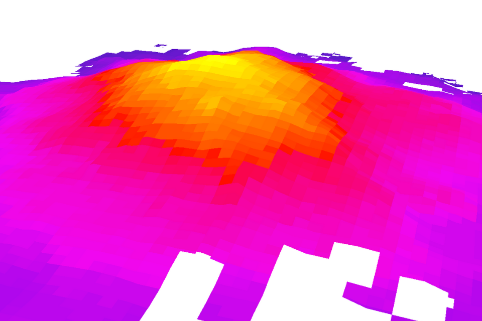
An underwater mountain double the height of the UK’s Ben Nevis has been added to a global map of the seafloor.

Read more of Large underwater mountain mapped near remote UK Overseas Territory

Related content and links

About Marine Science

The Marine Science blog showcases the latest developments and research in the marine and freshwater sectors across all government departments.

Find out more.

Topics

Sign up and manage updates

  • Email
  • Atom

Follow us

  • Twitter
  • LinkedIn
  • Instagram

Follow Cefas on Twitter

Tweets by @CefasGovUK

Recent posts

  • Opening up the ocean: why diverse voices are vital for the future of marine science
  • Seabed Carbon Risks: What Our Evidence Shows
  • Taking Flight- The new Clean Catch seabird bycatch monitoring and mitigation trial
  • Collaborative underwater TV surveys of Nephrops in the Irish Sea
  • From Listings to Lasting Protection: Strengthening Indonesia’s Capacity to Safeguard Threatened Sharks and Rays

Useful links

  • All GOV.UK blogs
  • All GOV.UK blog posts
  • GOV.UK
  • All departments
  • Accessibility statement
  • Cookies
All content is available under the Open Government Licence v3.0, except where otherwise stated
© Crown copyright